Exploratory Prototype · Paused
StreetEase
An exploratory React and Leaflet prototype for previewing street grades around a destination, with accessibility in mind. Development is paused while I reassess geographic scope, elevation-data reliability, and the processing required to support address searches worldwide.
Problem
Most map tools are designed for navigation, but they do not clearly communicate how physically demanding an area may be to walk.
For someone using a mobility aid or managing limited endurance, street grade can make a major difference in whether a route feels realistic or comfortable.
I wanted to explore how street geometry, elevation data, and mapping could be combined into a tool that makes terrain easier to understand at a glance.
What I've Built So Far
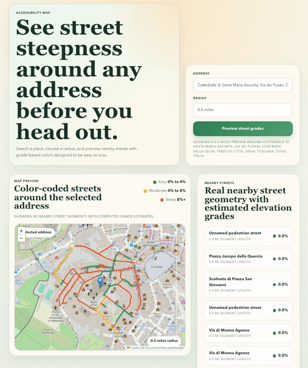
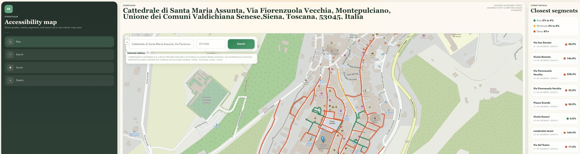
So far, I have built a responsive web prototype using React and Leaflet that allows users to search for a location, preview nearby streets within a selected radius, and view a color-coded street overlay representing grade difficulty.
Prototype work includes:
- A responsive React frontend built for web-first use
- Interactive map rendering with Leaflet and OpenStreetMap
- Address search with autocomplete suggestions
- Radius-based map preview centered on a selected location
- A color-coded street overlay concept for easier terrain scanning
- A lightweight backend API for search and street-grade requests
- Early caching and fallback handling for unreliable third-party APIs
- Resilience work around street lookup and elevation lookup failures
Technical Challenges
StreetEase has been a strong exercise in working with real-world data constraints. One of the biggest challenges has been reliability. Public mapping and elevation APIs can time out, rate-limit requests, or return incomplete street-naming data, which makes building a smooth experience much more complex than with a static demo. I explored a backend, caching, and fallback handling, but supporting arbitrary addresses worldwide remains unresolved. Processing time, resource requirements, and inconsistent data coverage are central constraints.
What I Learned
This project deepened my understanding of frontend-to-backend architecture, geospatial data workflows, API resilience, and accessibility-centered product design. It has also reinforced how much product quality depends on gracefully handling messy external data, not just on building a clean interface.
Why Development Is Paused
The original concept aimed to support any address worldwide. I’ve paused development to reassess that scope and the data and computing resources it would require. A smaller geographic area is one possible direction to evaluate before returning to the prototype.